
3.4 miles to Mt. Monroe summit, elevation 5,372 feet
4.5 miles to Mt. Washington summit (including Mt. Monroe side hike), elevation 6,288 feet
6-8 hours round trip
Difficulty: Pack the Aleve
The Ammonoosuc Ravine Trail, accessing the summits of Mt. Monroe and Mt. Washington, is equal parts majestic beauty and watch-your-step treacherous, sheltered tranquility and boot-to-boot hiker highway, destination hike and the fastest route between Point A (ground floor) and Point B (the AMC’s Lakes of the Clouds Hut). Combined with the Crawford Path and Jewell Trail for a nine-mile loop of New England’s tallest mountain, this is a can’t-miss New Hampshire hike.
The trail begins with a leisure stroll through dense forest that while still close to the road feels miles apart inside. There’s an easy rock hop across Franklin Brook and at the one-mile mark the Ammonoosuc Ravine Trail connects with the access trail from the Cog Railway base station. From here the trail turns right and follows the Ammonoosuc River for a stretch over rocky terrain where any elevation gain is gradual at best.

Eventually the trail reaches Gem Pool, a great spot for a snack break to take in the scenic waterfall and fuel up for the pending climb. Once across the Gem Pool’s outlet brook, the Ammonoosuc Ravine Trail’s initial nature walk is over and the real butt-kicking hiking begins with steep staircases that give way to full-on rock scrambles. There’s also several awe inspiring viewpoints as the trail overlooks the cascades and ultimately crosses the primary brook at a flat spot. It should go without saying that caution needs to be exercised around the cascade ledges.
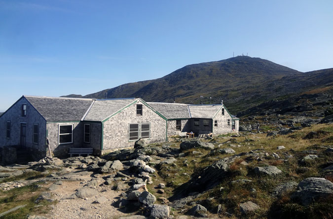
The rock scrambles are more frequent in the upper portion of the trail, which can be tricky when wet, especially on descent. The viewpoints are also on the rise as the shrinking trees thin out, delivering grand vistas of Mt. Washington. At the three-mile mark the trail emerges above treeline a short distance from the Lakes of the Clouds Hut and the Crawford Path junction. To summit Mt. Monroe, it’s a relatively easy, 0.3-mile side hike with only one spot where the footing gets tricky on a ledge. This diversion does require backtracking to return to the hut, but the views of the Presidential Range from the Mt. Monroe summit are 100 percent worth the effort.
From the Lakes of the Clouds Hut, it’s a 1.4 mile hike on the Crawford Path (also the Appalachian Trail) to the summit of Mt. Washington that’s tougher than it looks. The cone is one giant, seemingly-never-ending, rock pile, and the entire climb is out in the open and exposed to the elements. Whether you believe it or not, the Mount Washington Observatory doesn’t boast recording the world’s worst weather for nothing, so come ready for anything. It’s also best to mentally prepare for the Disneyland crowds sure to be found on the summit, especially on weekends. And don’t worry when you see the train, you’re not hallucinating.
Directions
When traveling on U.S. Route 302 East, turn left onto Base Road, which is located immediately after Fabayan’s Station Restaurant and a billboard for the Cog Railway. The trailhead parking lot is 5.4 miles from the intersection on the right. It is a White Mountain National Forest lot with a $3 per day fee.


Thank you, enjoyed reading it all the way till the end!
Plan on going up the Ammonoosuc and down the Jewell this weekend!! Thanks for the info. Good stuff!!!
Your point of view caught my eye and was very interesting. Thanks. I have a question for you.
Your point of view caught my eye and was very interesting. Thanks. I have a question for you.
If you’re looking to buy Fisch Fish quickly and securely, PvPBank is your go-to platform. Whether you need rare Fisch Fish, high-XP fish, or event-specific catches, PvPBank offers fast delivery and competitive prices. Skip the grind and get the fish you need with a few simple steps. Plus, their secure transactions ensure your personal information is safe. No hassle, no wait—just great service and top-quality Fisch Fish. Visit PvPBank now to grab your Fisch Fish and level up your game!
好文!2026年世界杯越来越近了,让我们共同期待这场全球足球盛宴。日期:2025-11-13 22:48:26 (-03)。
好文!2026年世界杯越来越近了,让我们共同期待这场全球足球盛宴。日期:2025-11-16 21:40:40 (-03)。
Can you be more specific about the content of your article? After reading it, I still have some doubts. Hope you can help me.
Valuable information. Lucky me I found your site by accident, and I am shocked why this accident didn’t happened earlier! I bookmarked it.
Your article helped me a lot, is there any more related content? Thanks!
What an inspiring and detailed account of the Ammonoosuc Ravine Trail! Just like hiking requires preparation, planning, and understanding the path ahead, starting a construction or development project in Dubai also needs careful preparation. For projects in DDA-regulated zones like Media City or Design District, obtaining a DDA Approval is essential before you can begin. Atech Interiors LLC helps clients navigate this process smoothly, handling all documentation, liaising with the Dubai Development Authority, and ensuring fast approval so your project can move forward without unnecessary delays—just like having a clear trail guide ensures a safer and more enjoyable hike.
Your article helped me a lot, is there any more related content? Thanks!
Trail starts easy, but after Gem Pool it becomes steep and technical, especially on wet rock.
Your article helped me a lot, is there any more related content? Thanks!
This hike guide for Mt. Monroe and Mt. Washington via the Ammonoosuc Ravine Trail gives a clear and simple picture of what hikers can expect on this challenging route. It explains the journey from peaceful forest paths and beautiful spots like Gem Pool to the steep rock scrambles and exposed summit climb, making it easy for even beginners to understand the difficulty level. The article also highlights important tips like being prepared for changing weather, tough terrain, and crowded summit conditions, which are common on the Presidential Range. Overall, it shows that this hike is both demanding and rewarding, offering amazing views, adventure, and a true New Hampshire mountain experience for those ready to take it on.
Thank you for your sharing. I am worried that I lack creative ideas. It is your article that makes me full of hope. Thank you. But, I have a question, can you help me?
Thank you, I have recently been searching for facts about this subject for ages and yours is the best I’ve located so far.
affordablecanvaspaintings.com.au is Australia Popular Online 100 percent Handmade Art Store. We deliver Budget Handmade Canvas Paintings, Abstract Art, Oil Paintings, Artwork Sale, Acrylic Wall Art Paintings, Custom Art, Oil Portraits, Pet Paintings, Building Paintings etc. 1000+ Designs To Choose From, Highly Experienced Artists team, Up-to 50 percent OFF SALE and FREE Delivery Australia, Sydney, Melbourne, Brisbane, Adelaide, Hobart and all regional areas. We ship worldwide international locations. Order Online Your Handmade Art Today.
I do not even understand how I ended up right here, but I thought this post was good. I don’t know who you’re however definitely you’re going to a famous blogger if you are not already 😉 Cheers!
The finish is smooth and flawless.
I think downloading it is also a good idea.
Magnificent beat ! I wish to apprentice while you amend your web site, how could i subscribe for a blog website? The account aided me a acceptable deal. I had been tiny bit acquainted of this your broadcast provided bright clear concept
Thanks for sharing your ideas. A very important factor is that college students have an option between federal government student loan plus a private education loan where it’s easier to decide on student loan online debt consolidation than in the federal education loan.
I have observed that rates for online degree experts tend to be an awesome value. For instance a full Bachelors Degree in Communication in the University of Phoenix Online consists of 60 credits from $515/credit or $30,900. Also American Intercontinental University Online offers a Bachelors of Business Administration with a full program element of 180 units and a cost of $30,560. Online studying has made obtaining your diploma much simpler because you could earn the degree from the comfort of your dwelling place and when you finish from office. Thanks for all the tips I have really learned from your blog.
Valuable information. Lucky me I found your website by accident, and I’m shocked why this accident did not happened earlier! I bookmarked it.
It is my belief that mesothelioma is most fatal cancer. It contains unusual features. The more I really look at it a lot more I am assured it does not conduct itself like a true solid cells cancer. If mesothelioma is often a rogue virus-like infection, hence there is the chance of developing a vaccine as well as offering vaccination for asbestos open people who are open to high risk associated with developing future asbestos relevant malignancies. Thanks for sharing your ideas about this important ailment.
This really answered my downside, thank you!
Thank you, I’ve just been searching for information about this topic for a long time and yours is the greatest I’ve found out till now. However, what about the bottom line? Are you certain in regards to the source?
Hi there, I found your blog via Google while looking for a related topic, your site came up, it looks good. I’ve bookmarked it in my google bookmarks.
Great work! This is the type of info that should be shared around the internet. Shame on the search engines for not positioning this post higher! Come on over and visit my website . Thanks =)
Looking for the Best Drive School of Motoring? Get expert driving lessons at best driving school for affordable and quality driving instruction.
I have noticed that over the course of developing a relationship with real estate entrepreneurs, you’ll be able to get them to understand that, in each and every real estate purchase, a commission rate is paid. All things considered, FSBO sellers tend not to “save” the percentage. Rather, they struggle to earn the commission by simply doing the agent’s task. In doing this, they invest their money in addition to time to perform, as best they’re able to, the duties of an realtor. Those duties include exposing the home by way of marketing, offering the home to buyers, building a sense of buyer urgency in order to prompt an offer, making arrangement for home inspections, managing qualification assessments with the lender, supervising maintenance, and aiding the closing of the deal.
Thanks for the detailed breakdown! I’ve been planning to hike the Ammo, and knowing exactly where the steep scramble kicks in (right after Gem Pool) is super helpful for pacing. I’ll definitely make sure not to skip the Mt. Monroe side trail—that 0.3-mile detour sounds totally worth the backtrack.
Thanks for the helpful post. It is also my belief that mesothelioma has an extremely long latency phase, which means that indication of the disease won’t emerge until finally 30 to 50 years after the original exposure to mesothelioma. Pleural mesothelioma, which is the most common variety and is affecting the area round the lungs, might cause shortness of breath, chest muscles pains, including a persistent coughing, which may cause coughing up maintain.
Hi, i believe that i saw you visited my blog thus i got here to ?return the choose?.I am trying to to find things to improve my web site!I suppose its good enough to make use of some of your ideas!!
UpvoteRocket delivers anonymous automated votes to 25+ game server toplists XtremeTop100, GTop100, TopG, MMtop200, RagnaTOP, MuTop100 and more. Undetectable, no bans, no risk. Pay only per successful vote delivered. Launch a campaign in seconds and rank higher today.
Nice read, I just passed this onto a friend who was doing some research on that. And he actually bought me lunch as I found it for him smile Thus let me rephrase that: Thanks for lunch!
hi!,I like your writing so much! share we communicate more about your article on AOL? I require an expert on this area to solve my problem. Maybe that’s you! Looking forward to see you.
I don’t think the title of your article matches the content lol. Just kidding, mainly because I had some doubts after reading the article.
You can definitely see your enthusiasm in the work you write. The world hopes for more passionate writers like you who are not afraid to say how they believe. Always follow your heart.
It?s in point of fact a nice and useful piece of info. I am satisfied that you shared this useful info with us. Please stay us informed like this. Thank you for sharing.
One thing I would really like to touch upon is that weightloss program fast can be carried out by the proper diet and exercise. People’s size not just affects the look, but also the actual quality of life. Self-esteem, despression symptoms, health risks, as well as physical abilities are affected in fat gain. It is possible to just make everything right and still gain. Should this happen, a condition may be the culprit. While excessive food and never enough workout are usually at fault, common medical ailments and widely used prescriptions can easily greatly increase size. Kudos for your post right here.
I love your blog.. very nice colors & theme. Did you design this website yourself or did you hire someone to do it for you? Plz reply as I’m looking to design my own blog and would like to find out where u got this from. thanks a lot
Oh my goodness! an amazing article dude. Thanks Nevertheless I’m experiencing issue with ur rss . Don?t know why Unable to subscribe to it. Is there anyone getting an identical rss downside? Anybody who knows kindly respond. Thnkx
Thank you for the good writeup. It in fact was a amusement account it. Look advanced to far added agreeable from you! By the way, how could we communicate?
Hey! I know this is somewhat off topic but I was wondering which blog platform are you using for this website? I’m getting fed up of WordPress because I’ve had problems with hackers and I’m looking at options for another platform. I would be great if you could point me in the direction of a good platform.
whoah this blog is great i love reading your articles. Keep up the good work! You know, a lot of people are looking around for this info, you can help them greatly.
Hello, you used to write excellent, but the last few posts have been kinda boring? I miss your tremendous writings. Past several posts are just a little out of track! come on!
Really appreciate 🙏 this message
Woah! I’m really enjoying the template/theme of this site. It’s simple, yet effective. A lot of times it’s tough to get that “perfect balance” between usability and visual appeal. I must say that you’ve done a superb job with this. Also, the blog loads super fast for me on Chrome. Excellent Blog!
Can you be more specific about the content of your article? After reading it, I still have some doubts. Hope you can help me.
Great weblog here! Additionally your website lots up fast! What web host are you using? Can I am getting your associate link on your host? I wish my website loaded up as fast as yours lol
I think this is among the most significant information for me. And i am glad reading your article. But should remark on some general things, The website style is wonderful, the articles is really nice : D. Good job, cheers
I?d must verify with you here. Which is not something I usually do! I enjoy studying a publish that can make people think. Also, thanks for permitting me to comment!
Thanks for your post. One other thing is that if you are marketing your property alone, one of the issues you need to be aware of upfront is when to deal with household inspection records. As a FSBO seller, the key concerning successfully shifting your property plus saving money in real estate agent profits is awareness. The more you know, the easier your sales effort will probably be. One area in which this is particularly essential is home inspections.
Thank you a bunch for sharing this with all of us you actually recognise what you are talking approximately! Bookmarked. Please additionally seek advice from my website =). We could have a hyperlink exchange contract among us!
I’m in awe of the author’s ability to make complex concepts accessible to readers of all backgrounds. This article is a testament to her expertise and commitment to providing valuable insights. Thank you, author, for creating such an engaging and enlightening piece. It has been an incredible joy to read!
Howdy! Would you mind if I share your blog with my myspace group? There’s a lot of people that I think would really appreciate your content. Please let me know. Many thanks
Riding a quad bike in Dubai sounds like an adventure worth trying. It gives visitors a chance to experience the desert in a more exciting way. I think it would be one of the best parts of a Dubai trip.
Grand League entries in contests with rollover prize pools from previous undersubscribed events.
great points altogether, you simply gained a brand new reader. What would you suggest in regards to your post that you made some days ago? Any positive?
Good blog post. What I would like to bring up is that laptop or computer memory is required to be purchased if the computer still can’t cope with that which you do by using it. One can mount two random access memory boards with 1GB each, as an example, but not one of 1GB and one of 2GB. One should make sure the manufacturer’s documentation for one’s PC to be certain what type of memory is essential.
Wonderful blog! Do you have any tips and hints for aspiring writers? I’m planning to start my own website soon but I’m a little lost on everything. Would you propose starting with a free platform like WordPress or go for a paid option? There are so many options out there that I’m totally overwhelmed .. Any tips? Kudos!
I have really learned result-oriented things through the blog post. Also a thing to I have noticed is that typically, FSBO sellers will certainly reject an individual. Remember, they would prefer to not ever use your services. But if you maintain a stable, professional romance, offering aid and remaining in contact for about four to five weeks, you will usually have the capacity to win a conversation. From there, a listing follows. Thanks
Thanks for your information on this blog. 1 thing I would choose to say is the fact that purchasing electronic products items through the Internet is nothing new. The truth is, in the past decades alone, the marketplace for online electronic devices has grown considerably. Today, you could find practically any kind of electronic tool and tools on the Internet, ranging from cameras in addition to camcorders to computer parts and video games consoles.
Hey very nice website!! Man .. Excellent .. Amazing .. I will bookmark your website and take the feeds also?I’m happy to find a lot of useful info here in the post, we need work out more strategies in this regard, thanks for sharing. . . . . .
Something else is that when you are evaluating a good on the web electronics retail outlet, look for web shops that are consistently updated, always keeping up-to-date with the newest products, the top deals, as well as helpful information on products. This will make certain you are doing business with a shop that really stays over the competition and gives you things to make educated, well-informed electronics acquisitions. Thanks for the vital tips I’ve learned through the blog.
Hmm it looks like your blog ate my first comment (it was super long) so I guess I’ll just sum it up what I wrote and say, I’m thoroughly enjoying your blog. I as well am an aspiring blog blogger but I’m still new to everything. Do you have any recommendations for beginner blog writers? I’d genuinely appreciate it.
It?s actually a nice and useful piece of info. I am happy that you simply shared this helpful information with us. Please keep us up to date like this. Thank you for sharing.
My brother suggested I would possibly like this blog. He was once totally right. This submit actually made my day. You cann’t consider simply how so much time I had spent for this info! Thanks!